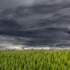
The U.S. Drought Monitor, produced by the National Drought Mitigation Center at the University of Nebraska-Lincoln, USDA, and NOAA, reports significant changes in drought conditions across the contiguous U.S. this week. Heavy rains in southern Florida have alleviated moderate to severe drought conditions. In contrast, much of the Eastern U.S. is experiencing worsening drought due to below-normal rainfall over the past few months, combined with rising temperatures, which have depleted surface moisture. Declining streamflows and dropping soil moisture levels have led to an expansive increase in drought coverage east of the Mississippi River.
In the West, there were notable changes with new dry conditions developing in the south-central and north-central Plains and Rockies. Despite some heavy rains outside southern Florida, most of the Upper Midwest saw no changes due to already above-normal precipitation.
Looking ahead, excessive rains are expected in the central Oklahoma Panhandle and parts of Texas and Kansas. Tropical Storm Alberto is projected to bring 3 to 8 inches of rain to southern Texas. Heavy rains are also forecasted for southeastern South Dakota, southern Minnesota, northern Wisconsin, southwestern Colorado, parts of the north-central Great Plains, the upper Mississippi Valley, and the northern Great Lakes region. New England and parts of northeastern Florida are also expected to receive significant rainfall.
However, dry weather is forecasted for the Far West, central and northern Texas, Oklahoma, and several other regions, with only minimal precipitation expected. Most of the U.S. is projected to experience above-normal temperatures, especially in the central and south-central Plains, northern Rockies, Intermountain West, and the Far West, with anomalies of 6 to 10 degrees Fahrenheit above normal in some areas.
The Climate Prediction Center’s 6-10 day outlook predicts continued above-normal temperatures for most of the contiguous U.S., with the highest probabilities in the Four Corners region, Carolinas, and Virginia. Below-normal temperatures are only expected in parts of the Pacific Northwest. Above-normal precipitation is favored in several regions, including the Pacific Northwest, Four Corners, Plains, Mississippi and lower Ohio Valleys, Great Lakes, southern Appalachians, Southeast, and Florida, with the highest chances in Arizona and New Mexico.