The National Drought Mitigation Center at the University of Nebraska-Lincoln has released its latest drought summary, detailing significant weather events and their impacts across the United States for the week ending July 9, 2024.
Key highlights:
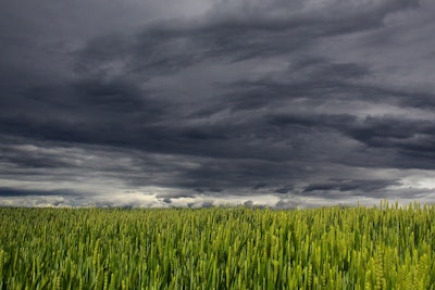
- Tropical storm relief: The first landfalling tropical storm of the season brought much-needed precipitation to East Texas and the Ozark Plateau.
- Temperature extremes: The West Coast experienced record-breaking heat, with California temperatures soaring 12-15 degrees above normal. Las Vegas set a new record at 120 degrees, and Death Valley saw five consecutive days with temperatures over 125 degrees, peaking at 129 degrees on July 7.
- Cooler midwest: Cooler than normal temperatures prevailed from the Rocky Mountains to the Midwest, with departures from normal ranging from 3-9 degrees below average.
- Precipitation variability: The Plains saw well above-normal precipitation, with some areas receiving 400-800% of their usual rainfall. In contrast, the Southeast experienced spotty, hit-and-miss thunderstorms, while parts of the Mid-Atlantic and the Northeast remained dry.
Regional updates:
- Northeast: Warmer than normal temperatures and spotty precipitation were reported. Drought conditions expanded in southern Maine, central Pennsylvania, and parts of New Jersey. Severe drought spread in northern Virginia and eastern West Virginia.
- Southeast: Scattered rainfall led to mixed drought conditions. Drought intensified in Tennessee, northern Alabama, and the Carolinas, with extreme drought conditions emerging in some areas.
- South: Temperatures varied, with significant rains in Oklahoma and parts of Texas due to Tropical Storm Beryl. Despite rains, drought conditions persisted in west Texas.
- Midwest: Cooler temperatures and varying precipitation led to improvements in some drought areas, particularly in Iowa and Missouri. However, dryness continued in northern Illinois, Indiana, and Ohio.
- High plains: Cooler temperatures and widespread precipitation led to drought improvements in Nebraska, Kansas, and southeast Colorado. However, drought conditions worsened in parts of South Dakota, Wyoming, and Colorado.
- West: Record heat and dry conditions dominated, with significant drought expansions in northern California, Oregon, and Washington. Some improvements were noted in western Montana and northern New Mexico.
- Caribbean: Puerto Rico remained drought-free, while the U.S. Virgin Islands received sufficient rainfall to maintain drought-free conditions.
- Pacific: In Alaska, drought adjustments were made with improvements in some areas. Hawaii saw moderate drought conditions expand due to recent rainfall patterns.
Looking ahead:
In the next 5-7 days, monsoonal precipitation is expected in the Southwest, while much of the West will remain dry. The Southeast and coastal Gulf areas are likely to receive the most rainfall, particularly from South Carolina to the Mid-Atlantic. The Midwest and Northeast are expected to stay wet. Temperatures will generally be above normal, except for the slightly cooler Southwest and parts of Texas.
The 6-10 day outlook indicates a high probability of above-normal temperatures nationwide, especially in the northern Rocky Mountains and the Southeast. The Four Corners region and Texas's Rio Grande area are expected to see the most precipitation, while the northern Rocky Mountains, Great Basin, and central California may experience below-normal precipitation.


