The U.S. Drought Monitor weekly report showed the eastern United States is grappling with intensifying drought conditions following weeks of insufficient rainfall and persistent high temperatures, particularly affecting the Ohio Valley, Mid-Atlantic, and Southeast regions. This week's drought summary highlights a significant increase in areas classified as abnormally dry and those experiencing moderate drought.
Conversely, parts of southern Texas and the Four Corners region received substantial relief from Tropical Storm Alberto, which delivered over 5 inches of rain in some areas, leading to improvements in drought conditions and causing localized flooding. This storm system also impacted the Upper Midwest and Northern Plains, where heavy rains alleviated some drought concerns but caused river and flash flooding.
In the Northeast, a slow-moving storm system from the Great Lakes brought some respite last week, reducing dryness in parts of New York and New England where recent rainfall erased short-term deficits. However, the broader region continues to struggle with escalating drought conditions due to prolonged dry spells and heatwaves.
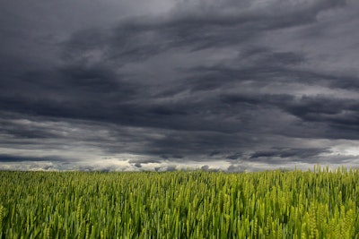
The Southeast has seen little to no rainfall over the past three to four weeks, compounded by multiple heat waves. This has led to deteriorating soil moisture and stream flows, affecting agriculture significantly as pastures turn dormant and crop yields are threatened. High evapotranspiration rates are drying out soils and vegetation rapidly, raising fire risks.
In the Southern U.S., while Tropical Storm Alberto's passage brought significant moisture to southern Texas and improvements in soil conditions, other areas like the Tennessee and Lower Mississippi Valleys, western Texas, and northern Oklahoma are experiencing rapid deterioration due to ongoing dryness and heat.
The Midwest has a split scenario where the Upper Midwest and northern Great Lakes have received ample rainfall, thanks to a northward-shifted storm track, improving conditions there. Conversely, the Middle Mississippi and Ohio Valleys are drying out significantly.
The High Plains saw mixed conditions; parts of southeastern South Dakota and southeastern Colorado benefited from Alberto's moisture, improving drought situations. However, other areas are seeing worsening conditions due to ongoing dryness and above-normal temperatures.
Looking ahead, forecasters predict that a couple of storm systems will bring needed rainfall to parts of the eastern U.S. over the next five days, potentially cooling off the region. However, the southern U.S. is expected to continue experiencing warmer than normal temperatures, with potential for excessive heat across the Gulf Coast states.
The Climate Prediction Center’s outlook for early July suggests above-average temperatures will likely continue across much of the southern U.S., with increased chances of above-normal precipitation in the Southwest and Midwest, which may offer some drought relief.
The U.S. Drought Monitor is jointly produced by the National Drought Mitigation Center at the University of Nebraska-Lincoln, the United States Department of Agriculture, and the National Oceanic and Atmospheric Administration.